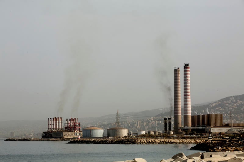
Jounieh, Lebanon listed as one of the most polluted cities in the world, it ranked the 5th air polluted region in the Arab world and 23rd in the World. Zouk power plant and heavy traffic are the two main reasons.
Beirut, 31 October, 2018 – Groundbreaking analysis of new satellite data by Greenpeace for the period of June 1 to August 31 reveals that several Middle Eastern cities feature in the most polluted cities in the world in terms of NO2 air pollution ranking.
NO2 is a dangerous pollutant released in the air when fuel, such as oil and diesel, is burned. The main sources of NO2 pollution in the Middle East are the transport, electricity production and manufacturing sectors.
Acute exposure to NO2 causes respiratory symptoms and lung damage while long-term exposure to NO2 increases the risk of chronic diseases and is associated with increased mortality rates worldwide [1]. In the European Union, exposure to NO2 is linked to an estimated 75,000 premature deaths per year [2].
The list of the 50 largest NO2 hotspots in the world includes 8 Arab cities namely: Dubai, Riyadh, Al Ahmadi (Kuwait), Baghdad, Jounieh (Lebanon), Cairo, Doha and Erbil(Iraq).
“Considering the region’s addiction to dirty oil it is not surprising to see Arab cities featuring prominently on the list of global NO2 emissions hotspots” declared Julien Jreissati, Arab World campaigner at Greenpeace Mediterranean. “What is shocking, to say the least, is the mismatch between the severity of the situation and the inaction of some Arab countries” continued Jreissati.
The solution to air pollution in the Middle East resides in the elimination of the region’s reliance on fossil fuels by drastically increasing renewable power generation and by radically reducing the number of internal combustion passenger cars in favor of electric powered personal & public transportation as part of an active and shared mobility system.
“It is time for Arab government to wake up and act upon this health crisis! Living in a clean and healthy environment is a basic right for any citizen and this can only happen through a rapid transition towards 100% renewable energy energy revolution and away from dirty fossil fuel which health and environmental cost cannot be afforded anymore” concluded Jreissati.
The analysis is based on new, publicly available data produced by the European Space Agency’s Sentinel 5P satellite between 1 June and 31 August 2018 [3]. Greenpeace is the first organisation to process the data into averaged NO2 levels on a gridded map.
Note to Editor
[2] https://www.eea.europa.eu/highlights/improving-air-quality-in-european/premature-deaths-2014
[3] https://earth.esa.int/web/guest/missions/esa-eo-missions/sentinel-5p
Briefing is available HERE
Series of maps and infographics are available HERE
Interactive global NO2 map available HERE