Queensland’s record-breaking floods are a frightening portent of what’s to come under climate change
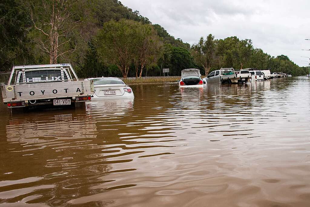
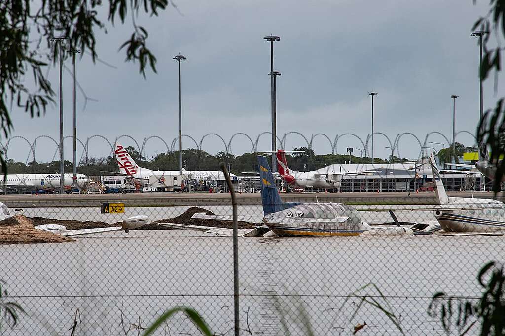
Unprecedented rain brought by Tropical Cyclone Jasper has triggered widespread flooding in far north Queensland, forcing thousands of people to evacuate. Cairns airport is closed, roads are extensively damaged, and residents in the city’s northern beaches are cut off by floodwaters.

Some rain gauges in the Barron and Daintree River catchments recorded more than 2m of rain over recent days, and more rain is expected. Water levels in the lower Barron River have smashed the previous record set by devastating floods in March 1977. On Monday morning, the Daintree River was more than 2m higher than the previous 118-year-old flood level recorded in 2019.
The full impacts of the flood are not yet clear. But there’s likely to be significant damage to properties and public infrastructure and negative effects on industries such as tourism and agriculture. Recovery is likely to take many months.
So let’s take a closer look at what caused this emergency – and what to expect as climate change worsens.
A ‘sweet spot’ for torrential rain
Tropical Cyclone Jasper crossed the coast north of Cairns on Wednesday last week, tracking over the remote Indigenous community of Wujal Wujal. Damage from wind and storm surge was minimal, but Jasper still produced more than 800mm of rain across the Daintree and Mossman River catchments.
Late Wednesday, the cyclone was downgraded to a tropical low. It crossed the southern Cape York Peninsula and headed towards the Gulf of Carpentaria. By Friday, local tourism agencies and operators announced they were back in business, inviting visitors back to the region.
However, by Saturday morning, a significant rainfall and flood emergency was unfolding across a 360-kilometre swathe from Cooktown to Ingham. So what happened?
The ex-cyclone stalled just inland from the southeast Gulf of Carpentaria, creating a sweet spot for torrential rain known as a “stationary convergence zone”. Incredibly moist tropical winds collided over a narrow zone between Port Douglas and Innisfail. This effect converged with northerly winds from the Gulf of Carpentaria and southeast trade winds from the Coral Sea. Local mountain ranges created extra uplift. All this led to non-stop torrential rain for 48 hours.
As a result, an emergency situation rapidly grew across Cairns and the Barron River delta to its immediate north.
Townsville floods: similar but different
This extreme flood event bears some similarity to that which caused significant damage to Townsville in February 2019. Both were associated with a stationary convergence zone caused by a stalled tropical low located to their northwest. In the case of Townsville, the tropical low did not budge for more than ten days. In that time, Townsville received the equivalent of a year’s average rainfall.
Otherwise, the two events are very different.
Firstly, the Townsville floods occurred during a neutral year – that is, in the absence of the climate drivers La Niña and El Niño. But the current flood event has occurred during an El Niño, when tropical cyclones are much less likely to occur in the Australian region, especially in early December.
Secondly, the deep tropical low that caused the 2019 Townsville floods was embedded in an active monsoon trough, which sucked in very moist equatorial air from Indonesia. But unusually, Cyclone Jasper did not form in such conditions. The monsoon trough is still to appear and form over northern Australia.
What’s climate change got to do with it?

As 2023 closes as the warmest year on record, there is growing global concern about the rise of extreme weather events such as floods, droughts and heatwaves.
The atmosphere and oceans are warming due to increasing emissions of greenhouse gases, largely caused by burning fossil fuels. This has led to a greater risk of extreme rainfall and flooding, such as the events we’re seeing now in far north Queensland.
For every 1°C rise in average global temperature, the atmosphere can hold an extra 7% water vapour. When the right atmospheric “triggers” are in place, this extra water vapour is released as intense rainfall.
It’s too soon to attribute the current extreme rain and flooding to climate change. But as the world continues to warm, such events will become more frequent and severe.
Already, extreme flood events globally are becoming more regular, and their magnitude is breaking many long-term rainfall and river flood records.
Looking ahead
Once the immediate crisis in North Queensland has subsided, local and state authorities will need to grapple with how to deal with the “new normal” of extreme weather events. The big question is: are they prepared?
Since the big Barron River flood in March 1977, considerable residential and commercial development has been permitted across the river’s floodplain. In many cases, these earlier developments were approved without full consideration of future floods. Many were also approved before local government planning started taking sea level rise into consideration.
The wider Cairns community will recover from this extreme event and will hopefully take on board any problems identified in the emergency responses. In future, emergency planning must take the effects of climate change more seriously. This includes increases in sea level, and more intense tropical cyclones, storm surges, rainfall and flooding.
As of this month, a climate emergency had been declared in 2,351 jurisdictions and local government areas around the world. As a result, many jurisdictions have developed response plans. In Australia, local governments should recognise climate change threats and risks by formally declaring a climate emergency.

Take action for environmental protection. Please make a donation today. Greenpeace exists because this fragile earth deserves a voice. It needs solutions. It needs change. It needs action.
DonateSteve Turton is Adjunct Professor of Environmental Geography, CQUniversity Australia
This article is republished from The Conversation under a Creative Commons license. Read the original article.


